


)
)
FREE SHIPPING
IN CANADA
IN CANADA
90 DAYS RETURN
GUARANTEE
GUARANTEE
CANADIAN OWNED
IN ONTARIO
IN ONTARIO

STARTING FROM
CAD$ 445.50
On Sale ForCAD$ 445.50
Omnia Product Expert is nline !
FOUND A LOWER PRICE? We'll Beat Any Lower Price You Find!
Some Condition Applies*
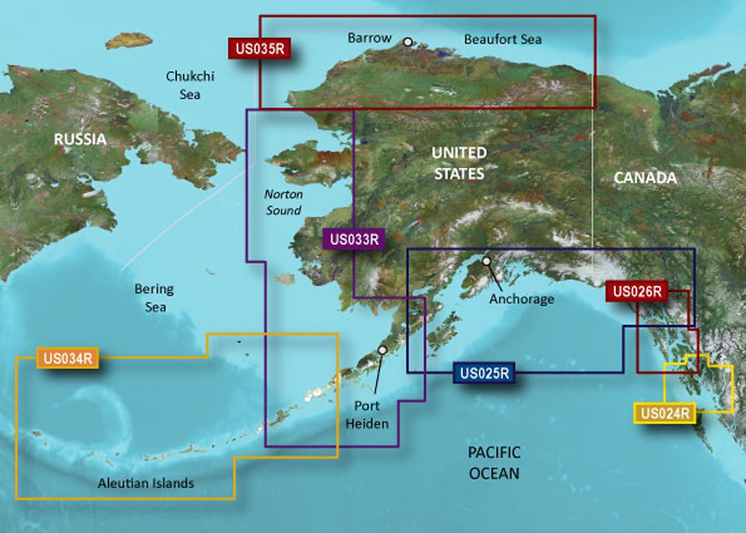
Garmin Bluechart 174 Marine Cartography 010-C0734-00 SKU Listing / Specs
| Purchase | Part Number | Image View | Name | Detail Specs | UPC |
|---|---|---|---|---|---|
|
SKU: 010-C0734-00
CAD$ 445.5
|
 Enlarged View |
Garmin Bluechart 174 Marine Cartography 010-C0734-00 SPECIAL ORDER
SPECIAL ORDER (Estimated Ship Date: 4 - 8 Weeks) UpdatedOn: 2/24/2026 12:00:00 AM |
Universal Fit Product. UPC: 753759069148 |
753759069148 |
Hot Product recommendation:


- UPC: 753759069148
- Weight: 136 grams