


FREE SHIPPING
IN CANADA
IN CANADA
90 DAYS RETURN
GUARANTEE
GUARANTEE
CANADIAN OWNED
IN ONTARIO
IN ONTARIO

STARTING FROM
CAD$ 179.79
On Sale ForCAD$ 179.79
Omnia Product Expert is nline !
FOUND A LOWER PRICE? We'll Beat Any Lower Price You Find!
Some Condition Applies*
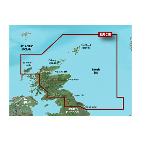
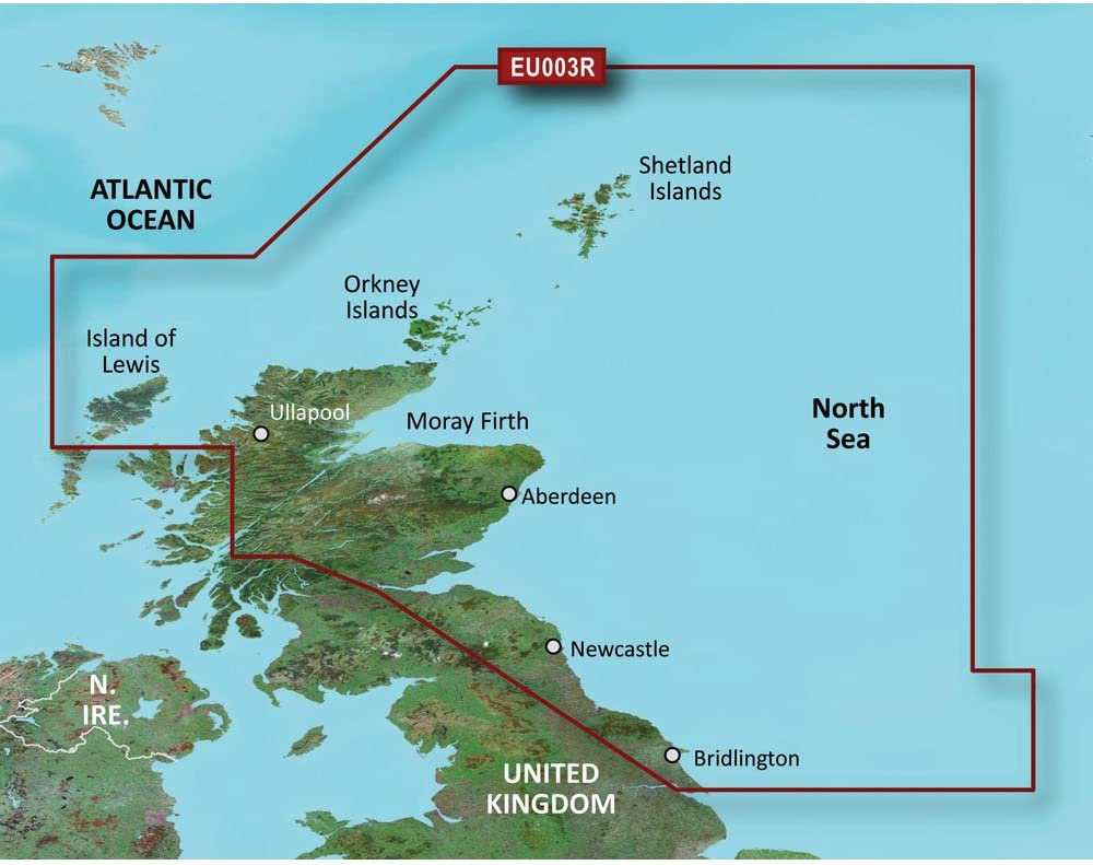
Garmin Bluechart 174 Marine Cartography 010-C0762-20 SKU Listing / Specs
| Purchase | Part Number | Image View | Name | Detail Specs | UPC |
|---|---|---|---|---|---|
|
SKU: 010-C0762-20
CAD$ 179.79
|
 Enlarged View |
Garmin Bluechart 174 Marine Cartography 010-C0762-20 SPECIAL ORDER
SPECIAL ORDER (Estimated Ship Date: 4 - 8 Weeks) UpdatedOn: 2/21/2026 12:00:00 AM |
Universal Fit Product. Marine Cartography; BlueChart 174; G3; Compatible With Chart Plotters; Region Code: HXEU003R; On SD/Micro-SD Card Product Description BlueChart ® G3 coastal charts provide industry-leading coverage, clarity and detail with integrated Garmin and Navionics data. Also included is Auto Guidance technology, which uses your desired depth and overhead clearance to calculate routes and provide a suggested path to follow - overlaid onto your chart. NOAA raster cartography is also provided as a free downloadable feature via the ActiveCaptain app. It gives your chartplotter paper chart like views of NOAA-surveyed areas in which individual points of interest are labeled with corresponding longitude and latitude information. |
753759091484 |
Hot Product recommendation:


Marine Cartography; BlueChart 174; G3; Compatible With Chart Plotters; Region Code: HXEU003R; On SD/Micro-SD Card