


IN CANADA
GUARANTEE
IN ONTARIO

CAD$ 279.34
Omnia Product Expert is nline !
FOUND A LOWER PRICE? We'll Beat Any Lower Price You Find!
Some Condition Applies*
Garmin Bluechart 174 Marine Cartography 010-C0884-20 SKU Listing / Specs
| Purchase | Part Number | Image View | Name | Detail Specs | UPC |
|---|---|---|---|---|---|
|
SKU: 010-C0884-20
CAD$ 279.34
|
 Enlarged View |
Garmin Bluechart 174 Marine Cartography 010-C0884-20 SPECIAL ORDER
SPECIAL ORDER (Estimated Ship Date: 4 - 8 Weeks) UpdatedOn: 11/27/2025 12:00:00 AM |
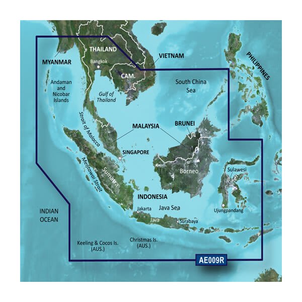
Universal Fit Product. BlueChart® g2 HD - HXAE009R - Singapore / Malaysia / Indonesia - microSD™ / SD™ Coverage: Detailed coverage of the southwestern portion of the Malay Peninsula through Singapore and the eastern side of Sumatra Island. Also included are numerous detailed charts covering areas such as Kuantan, Mal., Jakarta, Indo., and Merak, Indo., as well as Christmas, Keeling, and Cocos Islands. General coverage of Java, Celebas, the southern half of Borneo and other surrounding islands east to Timor. Our Advanced Chart Offering Derived from official charts and private sources to provide navigational aids, spot soundings, depth contours, tides and currents, and detailed harbors and marinasDepth Range Shading for up to 10 depth ranges enables you to view your target depth at a glance Up to 1-foot contours provide a more accurate depiction of the bottom structure for improved fishing charts and navigation in swamps, canals and marinas Shallow Water Shading feature allows for depth shading at a user-defined level to aid in navigation Advanced Chart Detail Detailed charts help the mariner guide their boat in and out of port with confidence. Depth Range Shading Displays high-resolution Depth Range Shading for up to 10 depth ranges so you can view your designated target depth. Detailed Contours BlueChart g2 HD features 1-foot contours that provide a more accurate depiction of bottom structure for improved fishing charts and enhanced detail in swamps, canals and port plans. WARNING: This product can expose you to chemicals which are known to the State of California to cause cancer, birth defects or other reproductive harm. For more information go to P65Warnings.ca.gov. This product may not be returned to the original point of purchase. Please contact the manufacturer directly with any issues or concerns. |
753759090166 |
Hot Product recommendation:


BlueChart® g2 HD - HXAE009R - Singapore / Malaysia / Indonesia - microSD™ / SD™
Coverage:
Detailed coverage of the southwestern portion of the Malay Peninsula through Singapore and the eastern side of Sumatra Island. Also included are numerous detailed charts covering areas such as Kuantan, Mal., Jakarta, Indo., and Merak, Indo., as well as Christmas, Keeling, and Cocos Islands. General coverage of Java, Celebas, the southern half of Borneo and other surrounding islands east to Timor.
Our Advanced Chart Offering
- Derived from official charts and private sources to provide navigational aids, spot soundings, depth contours, tides and currents, and detailed harbors and marinas
- Depth Range Shading for up to 10 depth ranges enables you to view your target depth at a glance
- Up to 1-foot contours provide a more accurate depiction of the bottom structure for improved fishing charts and navigation in swamps, canals and marinas
- Shallow Water Shading feature allows for depth shading at a user-defined level to aid in navigation
Advanced Chart Detail
Detailed charts help the mariner guide their boat in and out of port with confidence.
Depth Range Shading
Displays high-resolution Depth Range Shading for up to 10 depth ranges so you can view your designated target depth.
Detailed Contours
BlueChart g2 HD features 1-foot contours that provide a more accurate depiction of bottom structure for improved fishing charts and enhanced detail in swamps, canals and port plans.
WARNING: This product can expose you to chemicals which are known to the State of California to cause cancer, birth defects or other reproductive harm. For more information go to P65Warnings.ca.gov.
This product may not be returned to the original point of purchase. Please contact the manufacturer directly with any issues or concerns.