


)
)
FREE SHIPPING
IN CANADA
IN CANADA
90 DAYS RETURN
GUARANTEE
GUARANTEE
CANADIAN OWNED
IN ONTARIO
IN ONTARIO
STARTING FROM
CAD$ 322.07
On Sale ForCAD$ 322.07
Omnia Product Expert is nline !
FOUND A LOWER PRICE? We'll Beat Any Lower Price You Find!
Some Condition Applies*
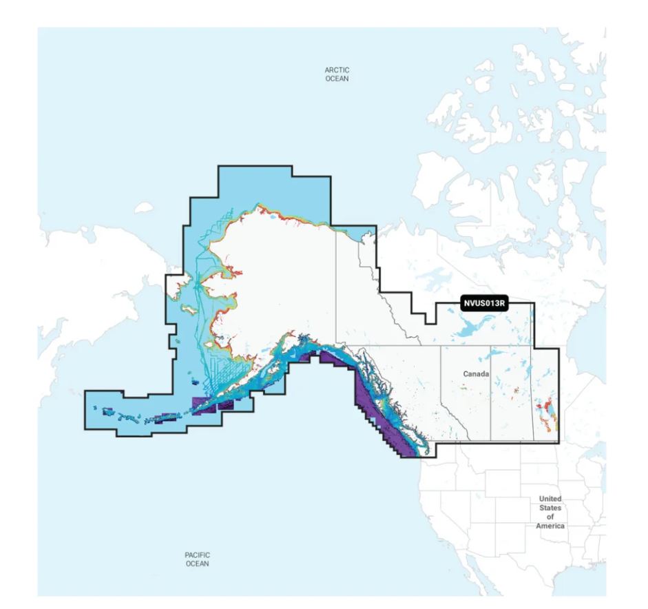
Garmin Navionics Vision+ Marine Cartography 010-C1485-00 SKU Listing / Specs
| Purchase | Part Number | Image View | Name | Detail Specs | UPC |
|---|---|---|---|---|---|
|
SKU: 010-C1485-00
CAD$ 322.07
|
 Enlarged View |
Garmin Navionics Vision+ Marine Cartography 010-C1485-00 INSTOCK: 4 LEFT!
INSTOCK: 4 LEFT! UpdatedOn: 11/27/2025 12:00:00 AM |
Universal Fit Product. Marine Cartography; Navionics Vision+; Region Code: NVUS013R; On SD/Micro-SD Card; One-Year Subscription Product Description Featuring vibrant colors, a streamlined interface and combined coastal/inland content with a popular Navionics® style color palette, Garmin Navionics+ cartography makes it easy to plot your course with the world’s No. 1 name in marine mapping. Access detail-rich mapping of coastal features, lakes, rivers and more. Integrated Garmin and Navionics® content offers coverage for boaters worldwide. Charts are constantly being enhanced with new and amended content: Thousands of updates are made every day. The one-year provided subscription gives you access to daily chart updates via the ActiveCaptain app. Combining the best of Garmin and Navionics automatic routing features, built-in Auto Guidance+ technology2 gives you a suggested dock-to-dock path to follow through channels, inlets, marina entrances and more. High-resolution depth range shading lets you select up to 10 color-shaded options and view your designated target depths at a glance. For improved fishing and navigation, up to 1 Feet contours provide a clear depiction of bottom structure for improved fishing charts and enhanced detail in swamps, canals, harbors, marinas and more. Community-sourced content provides useful points of interest, such as marinas, anchorages, hazards, businesses and more. Get recommendations from boaters with firsthand experience of the local environment. |
753759334901 |
Hot Product recommendation:


Marine Cartography; Navionics Vision+; Region Code: NVUS013R; On SD/Micro-SD Card; One-Year Subscription